
All Locations Lab - دانشکده مهندسی نقشه برداری و اطلاعات مکانی geospatialeng
- Multispectral and Hyperspectral RS
- 3Dimensional Remote Sensing
- Close Range Photogrammetry
- Satellite Geodesy Laboratory
- Radar Interferometry and Deformation Monitoring
- Location Base Solution Labratory
- Geodynamic Studies and Modeling Laboratory
-
Intelligent Remote Sensing Data Analysis Laboratory
- Geospatial-based Hydrologic Studies Lab
- Land Administration in Smart Cities
- Microwave Remote Sensing Laboratory
-
Gravimetry Laboratory
- Quantum algorithms Labratory
- Back
All Locations Lab


:Laboratory Supervisor
Dr. Rahim AliabaspourAcademic rank: Associate Professor Geospatial Information Systems (GIS) Contact Number: +982161114215 E-Mail: abaspour[AT]ut.ac.ir | 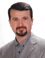 |
Definition and characteristics of the laboratory:
Objectives of the laboratory: