Microwavelab - دانشکده مهندسی نقشه برداری و اطلاعات مکانی geospatialeng
- Multispectral and Hyperspectral RS
- Three-Dimensional Remote Sensing
- Short-Range Photogrammetry
- Satellite Geodesy Laboratory
- Radar Interferometry and Deformation Monitoring
- All Locations Labratory
- Geodynamic Studies and Modeling Laboratory
-
Intelligent Remote Sensing Data Analysis Laboratory
- Location-Based Hydrology Laboratory
- Land Administration in Smart Cities
- Microwave Remote Sensing Laboratory
-
Gravimetry Laboratory
- Quantum algorithms Labratory
- Back
Microwave Remote Sensing Laboratory

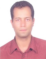
Laboratory supervisor:
Prof.Jalal AminiProfessor
|
|
Definition and characteristics of the laboratory:
Microwave Remote Sensing Laboratory
The Microwave Remote Sensing Laboratory specializes in the use of microwave frequencies for Earth observation, focusing on both active (such as Synthetic Aperture Radar - SAR) and passive (radiometers) remote sensing techniques. Microwave remote sensing is unique in its ability to penetrate clouds, vegetation, and even the ground surface, making it useful in various environmental and geophysical applications. Key research areas and activities of this laboratory include:
-
Synthetic Aperture Radar (SAR): Utilizing radar signals to capture high-resolution images of Earth's surface for applications in land use monitoring, urban development, and disaster management.
-
Soil Moisture Monitoring: Using microwave data to estimate soil moisture content, crucial for agriculture, hydrology, and climate studies.
-
Sea Surface and Ice Monitoring: Observing ocean surface properties, sea ice, and glaciers to study climate change, marine environments, and polar ice dynamics.
-
Atmospheric Studies: Analyzing atmospheric parameters such as humidity and temperature using passive microwave sensors.
-
Disaster Monitoring: Tracking natural disasters like floods, earthquakes, and landslides by capturing surface deformations and changes with SAR imagery.
-
Vegetation and Biomass Studies: Monitoring forests and estimating biomass by penetrating vegetation layers using microwave wavelengths.
This laboratory contributes to critical research in environmental monitoring, climate studies, and disaster management, providing insights that are not possible with traditional optical remote sensing techniques.


