
Smart Cities - دانشکده مهندسی نقشه برداری و اطلاعات مکانی geospatialeng
- Multispectral and Hyperspectral RS
- Three-Dimensional Remote Sensing
- Short-Range Photogrammetry
- Satellite Geodesy Laboratory
- Radar Interferometry and Deformation Monitoring
- All Locations Labratory
- Geodynamic Studies and Modeling Laboratory
-
Intelligent Remote Sensing Data Analysis Laboratory
- Location-Based Hydrology Laboratory
- Land Administration in Smart Cities
- Microwave Remote Sensing Laboratory
-
Gravimetry Laboratory
- Quantum algorithms Labratory
- Back
Land Administration in Smart Cities

:Laboratory Supervisor
Mahmoud Reza DelavarProfessorGeospatial Information Systems
|

|
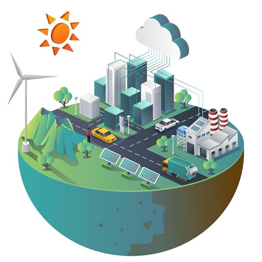
Definition and characteristics of the laboratory:
Land administration in smart cities refers to the integration of advanced technologies, such as Geographic Information Systems (GIS), Internet of Things (IoT), big data, and artificial intelligence, to manage land resources efficiently and sustainably. In the context of a smart city, land administration focuses on improving urban planning, property management, infrastructure development, and public services through technology-driven approaches. Key aspects of land administration in smart cities include:
- Digital Land Registry: Implementing a digital system for registering land ownership, transactions, and rights to ensure transparency, reduce fraud, and simplify processes for citizens.
- Smart Urban Planning: Using GIS and real-time data to optimize land use, zoning, and infrastructure development, ensuring efficient space allocation for housing, commercial areas, green spaces, and public services.
- 3D Land and Property Management: Developing 3D models of urban areas to manage land use more effectively, especially in densely populated cities where vertical property ownership and underground spaces are essential.
- Real-Time Monitoring: Leveraging IoT and remote sensing to monitor land usage, environmental changes, and urban development in real time, facilitating better decision-making and governance.
- Sustainable Land Use: Implementing smart land management strategies that promote sustainability, such as reducing urban sprawl, optimizing energy consumption, and preserving green spaces.
- Citizen Engagement: Using digital platforms to involve citizens in land management processes, such as reporting issues, participating in urban planning decisions, and accessing property-related services.
- Automated Land Valuation: Using AI and big data to assess property values dynamically, ensuring fair taxation and efficient property market functioning.
- Disaster Risk Reduction: Integrating geospatial data and risk analysis to identify vulnerable areas and plan urban infrastructure to mitigate the impact of natural disasters like floods, earthquakes, and landslides.
In a smart city, land administration is essential for promoting sustainable development, efficient resource use, and improving the quality of life for citizens through better governance and smarter infrastructure planning.